French National Hydrological Situation Bulletin of the 14th May 2025
Every month, the Hydrological Situation Bulletin (BSH) describes the state of water resources in mainland France during the previous month (precipitation, soil moisture, snow cover, river flow and dam levels, groundwater levels) with maps and an analysis of the situation.
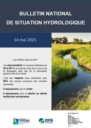
Across France as a whole, rainfall was close to normal for the month. There was above-average rainfall in northern Nouvelle-Aquitaine, Corsica, from northern Hérault to eastern Saône-et-Loire, and east of the Rhône corridor. However, rainfall was 30-70% below normal in northern and eastern Brittany, along the Belgian border and in Burgundy, as well as in Allier, south-eastern Occitanie and around the lower Rhône valley.
Topsoil has dried out or remains dry from the north of the Pays de la Loire to Normandy, from the Hauts-de-France to the north of the Côte-d'Or and west of Lorraine, in the Vosges, the Jura and locally in the Pays de Savoie and eastern Lorraine. They remain very wet in a small south-eastern quarter of France and are becoming wet in Corsica. The soil moisture indicator remains close to normal in the rest of the country.
Drainage is underway in a large part of the aquifers, with 61% of levels falling.
In April 2025, the hydraulicity map reveals marked contrasts in France, with excess flows in the south-eastern quarter and significant deficits in the east and the Paris basin.
As of 14 May 2025, four departments are affected by water use restrictions beyond the alert level, with two departments having implemented crisis measures.
Find all the French hydrological situation bulletins
The national hydrological situation bulletin (BSH national) describes the state of water resources on the metropolitan territory of the previous month.
It is the result of collaboration between different data producers and managers:
- Météo-France for meteorological data (rainfall, soil moisture, snow cover);
- the basin DREAL1 and Vigicrues service (ex. SCHAPI2) for data on river flows and the state of filling of dams (in collaboration with other national players, such as EDF3 , VNF4 and EPTB5 such as Seine Grands Lacs and Loire);
- BRGM for groundwater levels. These data are produced ten times during the year, which explains their absence from certain bulletins;
- the French Biodiversity Office (OFB) for observations on low water levels (between June and October).
The bulletin is produced under the aegis of the editorial committee made up of the various contributors to the BSH (data producers and managers), led by the International Office for Water (OiEau), in conjunction with the OFB and the Water and Biodiversity Directorate of the Ministry of Ecological Transition.
1 Regional Directorates for the Environment, Spatial Planning and Housing
2 Flood Forecasting Support Service
3 Électricité de France
4 Voies navigables de France
5 Territorial basin public establishments
Our related projects